Descrizione
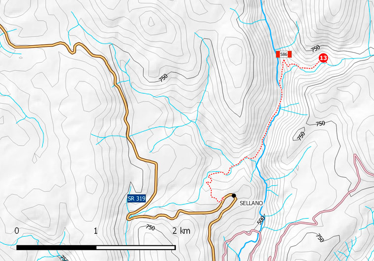
Da Sellano percorrere la SR319 in direzione Foligno per 200 m, quindi svoltare a destra (indicazione Cascata delle Rote) e percorrere una strada prima asfaltata e poi sterrata. Scendere nella valle del F. Vigi, sulla destra del lago artificiale e proseguire fino al punto in cui si attraversa il fiume (2,3 km dal bivio). Parcheggiare l’auto in uno slargo a sinistra prima di un ponticello sul Vigi (segnaletica CAI) e proseguire a piedi. Attraversato il fiume, si rientra sulla strada sterrata e quindi, dopo pochi metri, si gira a destra su un sentiero/mulattiera (n. 586), dove è presente un cartello in legno con indicato Setri-Peneggi. Dopo circa 100 m sulla destra è visibile la serie di salti finali della cascata delle Rote (a quota 550 m s.l.m.). Il percorso continua quindi in salita (poco più di 50 m di dislivello) per altri 300 metri circa, fino ad una spianata sulla destra. Da qui si arriva, in continua e graduale salita, in destra idrografica del Fosso delle Rote. Dopo circa 1 km dall’inizio della camminata, si arriva ad un guado a 660 m s.l.m. Prestare attenzione in corrispondenza della cascata asciutta (terreno scivoloso, per la presenza di muschi e limo) e quando si guada il Fosso.
From Sellano follow the SR319 toward Foligno for 200 mt, then turn right (sign Cascata delle Rote) on a paved road that turns to gravel. Go down into the Vigi River valley standing on the left of the artificial lake until the crossing point of the river (2.3 km from the turning point). Park the car in a lay-by on the left before the bridge on the Vigi river (CAI signage) and continue walking. Cross the river, go on the paved road and after a few meters turn right on the path n. 586 where there is a wood sign for Setri-Peneggi. After about 100 meters on the right you will come to the final jumps of the Rote waterfall (at 550 mt a.s.l.). The path continues up for other 300 meters (about 50 mt ascent), until a flat space on the right. Continue up until arriving at the hydrographic right of the Rote trench. After about 1 km from the beginning of the walk you’ll arrive at a ford at 660 mt. a.s.l. Be careful when approaching the finale jump (slippery soil for the presence of moss and mud) and when climbing down from the path to the trench to see the rapids (slippery and steep slope).
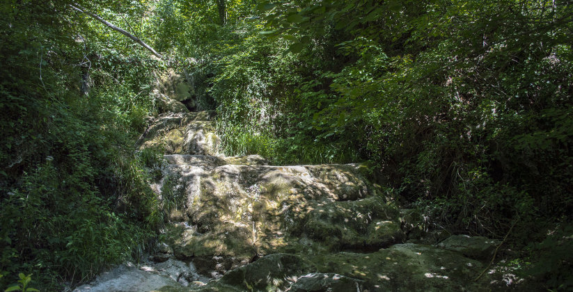
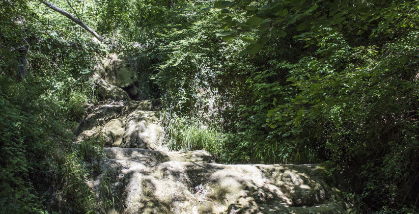
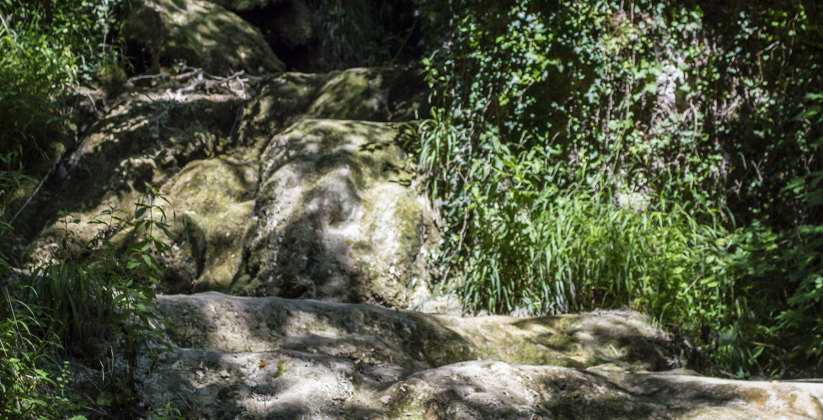
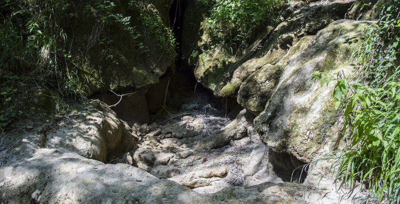
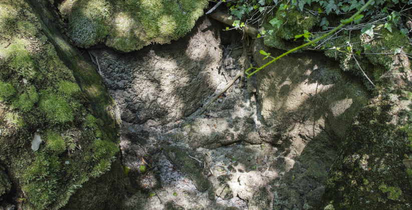
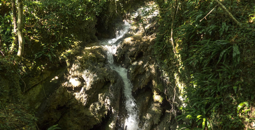
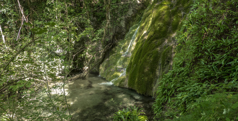
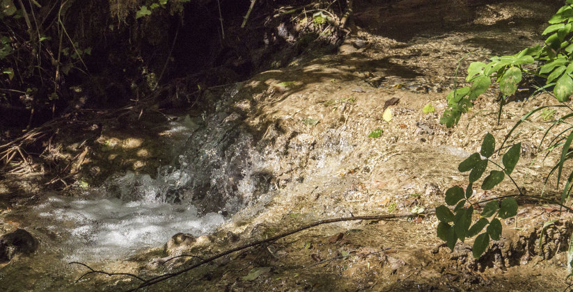
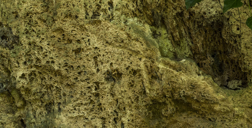
Il corso del Fosso delle Rote è caratterizzato da vari salti morfologici con rapide e cascate, dove la deposizione di travertini è tuttora attiva. La turbolenza dell’acqua infatti determina concentrazione, soprasaturazione e quindi precipitazione di carbonato di calcio su piante acquatiche (travertini fitoermali) e, nei salti più ripidi, quelli asciutti del tratto finale, anche su muschi (t. microermali). Si consiglia di iniziare la visita della valle del Fosso delle Rote nella parte alta, in corrispondenza di un guado posto a 660 m s.l.m.. Qui l’acqua scorre copiosa e forma una serie di rapide in corrispondenza di alcuni piccoli salti morfologici, che sono caratterizzati da sbarramenti con depositi fitoermali e vasche. La crescita degli sbarramenti, dovuta alla continua deposizione di travertini, influenza il defluire dell’acqua fino a deviarne il flusso. Proseguendo verso valle per circa 400 m e scendendo fino al letto del fosso, si incontrano delle cascatelle e, a valle di queste, alcuni piccoli sbarramenti simili ai precedenti. Scendendo ancora, le acque scorrono impetuose fino ad una briglia, con una grata che le convoglia. A valle di questa il fosso riduce la sua portata fino a ristagnare in corrispondenza di un piccolo sbarramento, che si trova a monte del primo dei grandi salti finali che permettono di superare rapidamente i 50 m di dislivello tra la valle sospesa del Fosso delle Rote e quella del Vigi. Alla base dell’ultimo salto sono presenti una piccola cavità e una marmitta dei giganti, morfologie tipiche delle cascate, dovute alla capacità erosiva delle acque qui particolarmente turbolente.
The flow of the Rote Stream is characterized by several morphologic steps, with rapids and cascades, where travertine deposition still occurs. The turbulence of the water flow allows concentration, over-saturation and precipitation of calcium carbonate on aquatic plants (phytohermal travertine) and at the steeper jump also on the moss (microhermal travertine).
The visit can start from the top, at the ford at 660 mt a.s.l. Here the water flows in great quantity and forms a series of rapids in correspondence of small morphological steps, that are characterized by barrages with phytohermal deposits and pools over them. The water flow is affected by the growth of the barrages: it tends to deviate when the barrage is too high to overstep. Found a good point for the ford, proceed uphill on the other side of the valley. Along the way are visible a series of rapids and waterfalls. After a few hundred meters you come to a waterfall. This is about ten meters high. A cliff of phytohermal travertines is present on the right – witness of an ancient waterfall.
Down in the valley the water flows impetuous until a weir that channels the water, after which the stream reduces its flow rate becoming a simple rivulet and finally stagnant.
The final part of the stream shows some jumps nearly 50 meters high that are dry and covered by phytohermal and microhermal travertines. At the bottom of the last jump there are some typical waterfall morphologies due to the erosive capacity of the water, which is here particularly turbulent (a small cavity and a giant’s kettle).
Video
Classificazione
- Area F.Vigi
- Tematica Geomorfologia
Localizzazione
- Latitudine42°54’13” N
- Longitudine12°56’21” E
- Quota Max660
- Quota Min550
- IGM serie 25324I
- CTR324080